

Federal $50 Million Boost Revitalizes Calhoun Wetlands
A major multi-phase restoration project aims to enhance ecosystem health and recreational access around Red’s Landing and Gilead Slough.

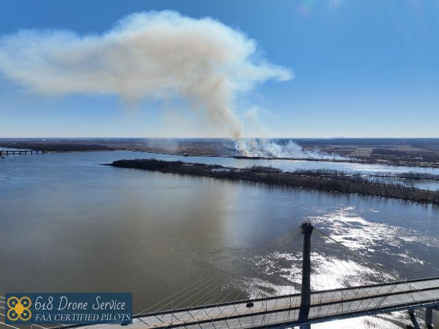
 CALHOUN COUNTY - A $50 million federal investment is reshaping wetlands and recreation access along the rugged western side of Calhoun County, Illinois, where the U.S. Army Corps of Engineers’ St. Louis District is overseeing a multi-phase restoration effort around Red’s Landing and Gilead Slough as part of the Upper Mississippi River Restoration program.
U.S. Army Corps of Engineers officials said work is scheduled as part of a broader cycle of projects planned through 2036, with an active restoration phase set for 2025 and 2026.
Get The Latest News!
Don't miss our top stories and need-to-know news everyday in your inbox.
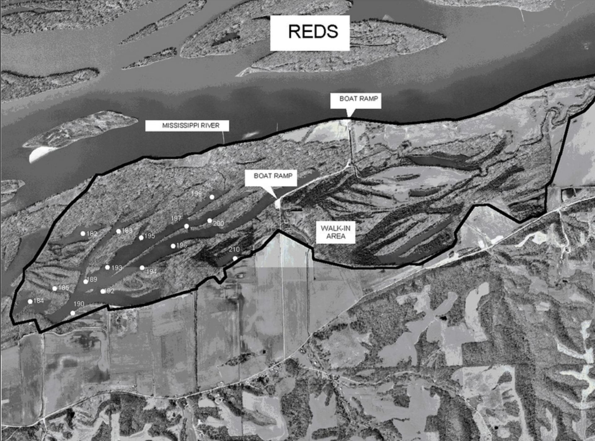
The Red’s Landing Wetlands Habitat Restoration and Enhancement Project focuses on restoring ecosystem health in Pool 25 of the Mississippi River near Gilead, Illinois. Red’s Landing is a 2,300-acre wildlife management area that provides habitat for migratory birds and native fish.
Gilead Slough, a nearby backwater area, is included in plans intended to improve water level management and reduce sedimentation.
The U.S. Corps of Engineers said the project goals include enhancing wetland habitat through water control structures, reforestation, and bank stabilization to support species such as the mallard and wood duck.
"Funding is being used for infrastructure that includes water control structures and a sedimentation deflection berm of about 8,000 feet, designed to shield wetlands from silt carried by the river," the U.S. Corps of Engineers said. "The project also calls for installing pump stations to help managers replicate natural flood cycles. Habitat work includes extensive reforestation of bottomland hardwood forests and restoration of aquatic habitats, including Gilead Slough."
The Corps’ stated aim extends beyond ecological restoration to local tourism, with plans intended to boost outdoor recreation and eco-tourism. The 2025 Rivers Project Master Plan suggests upgrades to restrooms, boat ramps, and primitive camping sites, and also references collaboration with the Center for American Archeology to protect cultural sites.
The USACE Rivers Project Office manages the lands, often working with the Illinois Department of Natural Resources. Public access generally includes boat ramps and primitive camping areas, and recent Corps recommendations have emphasized repairing restrooms and adding shoreline fishing areas. Although the Corps owns much of the land, it is often managed as a state wildlife management area.
The active restoration phase in 2026 is expected to include sedimentation deflection work, including construction of a 3-foot-high riverside berm and installation of water control structures, described as stop-log risers, to regulate wetland levels. Separately, the nearby Lock and Dam 25 is undergoing guide cell construction through October 2026, which may result in occasional barge activity in the area. Adaptive management and habitat monitoring are expected to continue into the late 2020s to assess reforestation success.
Recreation planning in the revised 2025 Master Plan identifies Red’s Landing as a focus for low-impact development, including formalizing primitive campsites on the west side of Calhoun County. The plan also suggests shoreline fishing access, enhancements to existing boat ramps, restroom replacement or repair, and small shelters in high-traffic areas. It also calls for new signage and interpretive programs tied to cultural and archaeological history, with proposed facility locations detailed in a Master Plan appendix.
For hunters, waterfowl blinds at Red’s Landing are overseen by the Illinois Department of Natural Resources and are typically allocated for three-year periods through a public lottery. For the Godar Complex, including Red’s Landing, drawings take place at the Calhoun County Fairgrounds north of Hardin. Registration typically begins at 9 a.m. on a Sunday in early June, with the draw at 1 p.m.
Under daily use rules, if a blind builder does not occupy the site at least a half-hour before legal shooting time, the blind becomes available to other hunters on a first-come, first-served basis for that day.
Primitive camping in the Mississippi River State Fish and Wildlife Area is governed by both Corps and IDNR regulations.
More like this:


- Most Popular


- Top Stories
- Most Recent
- Sign In
- Home
- Video
- News
-
Weather
 Sponsored by Michael Ryan Exteriors - Roofing Professionals
 - Sports
- Obits
- Events
- Radio
- AP News
- Shop Local
- Classifieds
- Autos
- Real Estate
- Directory
Follow Us
Copyright © 2026 RiverBender.com All rights reserved.
primary