


Heavy Rain Disrupts Friday, July 31, 2026, Commute Across Region
Morning storms soaked roads around Alton and St. Louis, creating dangerous travel conditions. Forecasters say a second round later Friday could bring a more serious weather threat.

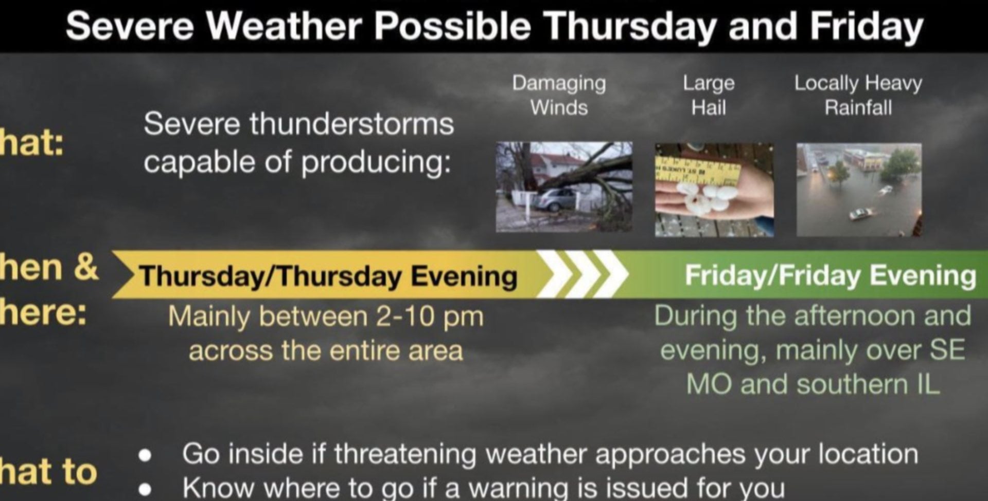
 ALTON - Heavy rain made for a difficult Friday morning, July 31, 2026, commute in the region as the first of two storm systems moved through the St. Louis area, according to the National Weather Service in St. Louis, which said additional storms later in the day could become strong to severe.
Get The Latest News!
Don't miss our top stories and need-to-know news everyday in your inbox.
The weather service said Friday morning storms were moving through the region, with heavy rainfall reported, which made commuting difficult, and some vehicles hydroplaned while “moving too fast.” The agency said the early storms were not expected to be severe, though “a few wind gusts up to 30-40 mph cannot be ruled out.” It also said “some areas could see an inch of rainfall.”
Forecasters said the morning storms were expected to move out around midday, followed by a lull in activity between noon and 3 p.m. During that period, “there’s the possibility for some spotty, light rain showers,” and “the sun will also make an appearance for a short duration, which will build fuel for the second round of storms later this afternoon.”

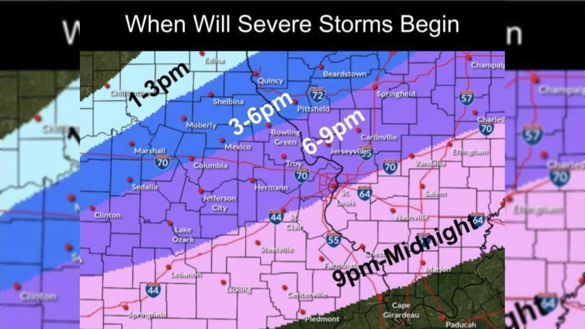
The National Weather Service in St. Louis said weak showers and thunderstorms were forecast to move west to east across the area Friday morning, with additional storms expected along a cold front. “Some of these storms may be strong to severe with damaging winds and a brief, weak tornado or two possible,” the agency said.
The entire viewing area, except the easternmost portion of the St. Louis area and in Illinois, was under a Level 2 risk out of 5 for severe storms Friday afternoon and evening. Forecasters said the amount of sunshine received during the midday break in activity would help determine how strong the second system may become.
Looking beyond Friday, the weather service said “a damp and chilly weekend is expected across the region, particularly on Saturday,” before warmer and more humid conditions return next work week.
“Some showers are expected on Saturday with a high of near 75 degrees,” the agency said, adding that it would be “much cooler than it has been” with scattered showers again Saturday and a high near 80 degrees. Monday is expected to be partly cloudy with a high of 80 to 85 degrees and no rain predicted. On Tuesday, there is a 20% chance of afternoon showers with a high of 85 degrees.

More like this:

- Most Popular



- Top Stories



- Most Recent



- Sign In
- Home
- Video
- News
-
Weather
 Sponsored by Michael Ryan Exteriors - Roofing Professionals
 - Sports
- Obits
- Events
- Radio
- AP News
- Shop Local
- Classifieds
- Autos
- Real Estate
- Directory
Get the RiverBender App


Follow Us
Copyright © 2026 RiverBender.com All rights reserved.
primary