


National Weather Service: Severe storms move through area Sunday night
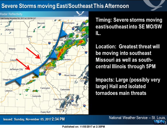
ST. LOUIS - Thunderstorms becoming numerous continuing into the early evening is the forecast tonight in the St. Louis region. Highest severe weather threat is until 7 p.m.
Get The Latest News!
Don't miss our top stories and need-to-know news everyday in your inbox.
The National Weather Service in St. Louis said there is potential for isolated tornadoes during the storm.
Unsettled and increasingly stormy weather is expected today. A cold front will push southeast across the region leading to extensive thunderstorm development roughly along the I-44 corridor in Missouri and I-70 corridor in Illinois.
The thunderstorms will then track southeast across southeastern Missouri and southwest Illinois through the late afternoon and early evening. Some of the storms will likely be severe with large hail and damaging winds.
More like this:


- Most Popular


- Top Stories



- Most Recent



- Sign In
- Home
- Video
- News
-
Weather
 Sponsored by Michael Ryan Exteriors - Roofing Professionals
 - Sports
- Obits
- Events
- Radio
- AP News
- Shop Local
- Classifieds
- Autos
- Real Estate
- Directory
Get the RiverBender App


Follow Us
Copyright © 2026 RiverBender.com All rights reserved.
primary