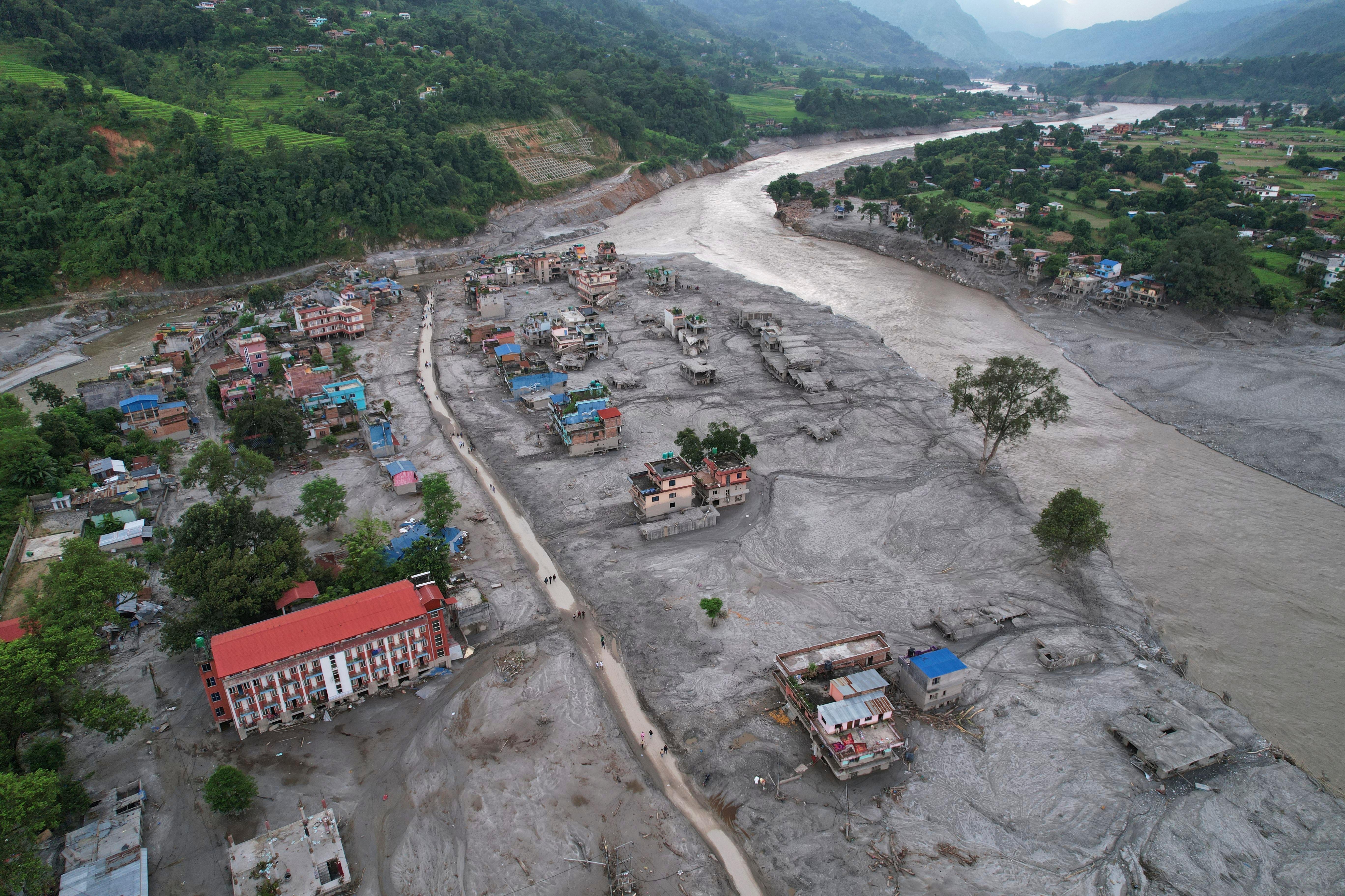

CARABALLEDA, Venezuela (AP) — The collapse of public housing buildings in the Venezuelan state of La Guaira following two catastrophic earthquakes in June can be traced back to their beginnings in 2010, experts and former officials told The Associated Press.
It was then that mudslides and heavy rain displaced more than 100,000 people across the country, and the Venezuelan government raced to ease the humanitarian crisis by constructing scores of apartments on the strip of land flanked by crystalline waters of the Caribbean Sea to the north and lush mountains to the south.
Get The Latest News!
Don't miss our top stories and need-to-know news everyday in your inbox.
The buildings, quickly erected in silty soil, were no match for the power of the back-to-back earthquakes on June 24, experts told the AP in dozens of interviews. The quakes killed more than 6,500 people and left over 17,000 homeless.
Here are some takeaways from the AP’s investigation.
— In the rush to build homes, the government disregarded dangers posed by the area’s history of mudslides and floods, which could enhance the risks posed by earthquakes. That’s because the buildings would be constructed on the loose, rocky soil that had been deposited there over centuries by floods and mudslides. The area’s proximity to the San Sebastian Fault line — running off the coast and right underneath La Guaira state — could also compound risks.
— Apartment towers went up in the state's parish of Caraballeda as part of the government’s signature housing program. People assigned those apartments were delighted when they finally received the keys, but they did not know that the height of the buildings would make them prone to collapse. That is because buildings that were between 10 and 20 floors could end up swaying at the exact same pace as the seismic waves, in a phenomenon known as resonance. The syncing results in the building swaying farther and longer, putting additional pressure on columns and increasing the likelihood of damage and collapse, experts said.
— With magnitudes of 7.2 and 7.5, the earthquakes were incredibly powerful by themselves. But they also dealt the very type of blow engineers fear most, a near-fault pulse. Central University of Venezuela geologist Michael Schmitz said that when the fault shifted, seismic energy stacked up at the front of the rupture as it moved eastward, delivering “a very strong blow” to the base of buildings, abruptly knocking their support and leaving them unable to dissipate energy by swaying.
— Unlike the magnitude of an earthquake, the intensity of the shaking varies from community to community and even street to street. The government had let local seismic instruments go dark, leaving scientists without data to determine the intensity of the shaking. That’s when Eduardo Miranda, a Stanford University professor of civil and environmental engineering, and his colleagues turned to analyzing video?captured by two security cameras near a bowling alley in Caraballeda, the most affected community in La Guaira. The footage shows eight buildings collapse simultaneously in less than a second.
— By carefully tracking the motion frame by frame, the team reconstructed how the?earthquake produced the motion seen on camera, according to a paper produced by Miranda’s team that was shared with the AP. That analysis?revealed one of the largest ground motions ever documented in the?world?and has provided the only?quantitative information on the ground-motion of the quake near the rupture. Miranda said it would have been difficult for structures meeting safety standards in Japan, which has among the strictest building codes, to have survived what happened June 24.
— The paper under peer review for publication in The Seismic Record, the online journal of the Seismological Society of America, determined that buildings in Caraballeda were pushed so far in one direction for so long that they hit their breaking points, Miranda said.
— It is not known whether government contractors followed Venezuela’s building codes. It is also not known whether officials conducted soil studies before construction began, or whether those studies were ignored. The government has not made public blueprints, soil studies or inspection records. Francisco “Farruco” Sesto, who headed the office responsible for then-President Hugo Chávez’s housing program, did not respond to an interview request from AP.
— The government of acting President Delcy Rodríguez has not provided any information regarding on-site forensic analyses that experts say are crucial to determine the causes and responsibilities, but its cleanup work, including dynamiting damaged buildings, is underway and so is a rebuilding effort. Experts said they hope the government does not simply repeat the mistakes of 15 years ago and instead takes a careful and considered approach to its rebuilding efforts. They also said the cost of additional design and construction work needed to build high-rises capable of resisting earthquakes in the region will likely dissuade the state and some private investors from developing certain areas.
___
Burke reported from San Francisco. Associated Press writers Michael Biesecker in Pittsburgh and Ryan Manzuk and Marshall Ritzel in New York contributed to this report.